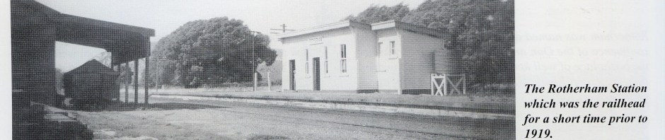
Waiau Branch [9A]: Rotherham Station
There is little today to suggest that Rotherham was once part of a railway network that connected the farms and settlements of the Amuri Basin with Christchurch and the wider South Island. The railway tracks have disappeared, the station buildings have gone, and the trains that once stirred the quiet countryside have become memories.
Yet for almost sixty years, the railway was woven into the everyday life of Rotherham.
The old Rotherham railway station was more than a place where passengers climbed aboard a train. It was a gateway for people, livestock, wool, farm produce, machinery, mail and news. For a rural community in the early twentieth century, the arrival of the railway represented something profound: connection.
A railway long dreamed of
The story began well before a train reached Rotherham.
The railway from Christchurch through the Weka Pass reached Culverden in February 1886. For decades afterwards, there was vigorous debate about where the railway should go next. The Amuri and Hurunui districts were strategically important farming country, and there were grand ambitions that the railway might eventually become part of a major northern route towards Marlborough and Nelson.
Rotherham was one of the settlements hoping to benefit.
Rotherham itself had been laid out in 1877, largely to provide a township and homes for workers serving the surrounding pastoral estates. By the early twentieth century it had become an established rural community, with its store, hotel, school, churches, farms and businesses. A railway would transform its possibilities.
In 1914, work finally began on extending the railway from Culverden towards Waiau, passing through Rotherham. Construction continued despite the difficulties of the First World War, and the completed line to Waiau was officially opened on 15 December 1919. It became known as the Waiau Branch.
For Rotherham, the railway age had arrived.
A station surprisingly grand for a small settlement
The Rotherham station was the ninth station on the Waiau Branch and stood about 57 kilometres from Waipara.
By railway standards, it was an ordinary rural station—but there was one intriguing exception.
The station building was considerably larger than might have been expected for a settlement the size of Rotherham. One explanation is that railway planners may once have anticipated Rotherham becoming the terminus of the line. Had that happened, the station would have had an importance considerably greater than its eventual role as an intermediate stop between Achray and Waiau.
The station yard included the essential facilities of a farming district: a station building, goods facilities, loading banks and stockyards. The railway was not simply there for passengers. In a pastoral community, moving animals and agricultural produce was every bit as important as moving people.
A 1917 government report records that the railway works at Rotherham included completed sidings, stockyards, holding yards and a loading bank, together with an approach road from the township. The railway was therefore already physically becoming part of Rotherham’s landscape before the complete line to Waiau officially opened.
The railway and the farming community
Imagine Rotherham in the 1920s.
There were no modern highways, refrigerated trucks or instant communications. Travelling to Christchurch was a considerable undertaking. A railway offered something precious: reliability.
Farmers could send stock and produce towards the markets. Wool could begin its journey to brokers and exporters. Goods could arrive from Christchurch and beyond. Machinery, building materials, coal, household supplies and other necessities could be transported more efficiently.
The railway also brought people.
There were passengers travelling for business, shopping, medical appointments, family visits and social occasions. Children and young people could travel further afield. Visitors could reach the district more easily. Railway employees themselves became part of the local community.
The train was also a carrier of information. In an era before the internet, television and even widespread telephone ownership, the arrival of a train was an event. Newspapers, letters, parcels and news from elsewhere arrived with it.
The railway connected Rotherham to a much bigger world.
The Great Northern dream
The importance of the line becomes even clearer when viewed against the ambitions of the time.
The railway through the Amuri Basin had originally been associated with much larger plans for a northern railway route. For many years there were hopes that the line would continue beyond Waiau, eventually reaching Kaikōura and Marlborough.
Those dreams were never realised.
Instead, in the 1920s, the decision was made to develop the Main North Line along the coast. The coastal railway eventually reached Picton, while the inland route through Rotherham and Waiau remained a branch line.
This decision quietly changed Rotherham’s railway destiny.
What might once have become a significant through route became a rural branch line serving the communities of North Canterbury.
Nevertheless, the Waiau Branch remained important. The Culverden Express became one of the best-known trains in North Canterbury, supplemented by mixed trains carrying both passengers and goods. Services beyond Culverden to Waiau operated several times a week.
A working railway, not a museum piece
For generations, the railway was simply part of life.
The station yard would have been a place of activity: wagons being shunted, livestock being loaded, goods handled, passengers waiting and railway staff going about their work.
Photographs of the station in its later years reveal a distinctly rural railway environment. The station building stood beside the track, with the goods shed and loading facilities nearby. The stockyards remained a visible reminder of the importance of sheep and farming to the local economy.
The railway was practical rather than glamorous—but that practicality was precisely its value.
In 1966 aerial photographs, the station yard still showed the stockyards and nearby houses. By 1975, much had changed. The stockyards had disappeared, and the goods shed had been removed and sold for relocation. The rural economy and transport system were evolving rapidly.
The end of the railway age
By the 1960s and 1970s, road transport was increasingly taking over the work once performed by branch railways.
Trucks could travel directly from farm to destination. Cars gave families greater independence. Improvements to roads reduced the railway’s former advantage.
The Waiau Branch was eventually closed on 15 January 1978. The closure marked the end of an era that had begun with such optimism nearly sixty years earlier.
For a while, the old station building remained.
It was photographed in June 1986, eight years after the railway had closed and the track had been lifted. The station sign was still present—a poignant reminder of what had once been there.
There were even plans to move the building and give it a new life with the Weka Pass Railway. Sadly, the building had deteriorated too far for those plans to proceed. It was eventually sold for removal in 1993.
And so the station disappeared from Rotherham’s physical landscape.
What remains?
Although the station itself is gone, traces of the railway survive for those who know where to look.
The old railway formation can still occasionally be recognised in the countryside. Some loading-bank remains have survived, and the alignment itself provides a fascinating reminder of the route once followed by trains.
There is also an intriguing surviving piece of railway infrastructure known locally as the Old Train Tower. Research following the 2016 Kaikōura earthquake identified the structure as a vintage concrete railway building, probably dating from the period when the Waiau Branch was being constructed between 1914 and 1919.
These fragments are easy to overlook.
But they are part of a larger story.
Listening for the train
Today Rotherham is a peaceful settlement surrounded by the broad landscapes of the Amuri Basin, with the Waiau River nearby and the mountains forming the distant horizon.
It is difficult to imagine the sound of a locomotive approaching the station.
Yet for generations that sound would have been familiar: the distant rumble, the whistle, the clatter of wheels, the movement of wagons and the purposeful activity of a railway yard.
The railway changed Rotherham—not by turning it into a large town, but by giving a small rural community a vital connection with the rest of the country.
Its disappearance is therefore more than the loss of a railway line.
It is the disappearance of a way of life.
The old Rotherham station may have vanished, but its story remains embedded in the landscape. In the roads, farms, surviving railway formations and memories of local families, there are still echoes of the days when the train came through the Amuri Basin.
And perhaps that is the most fitting way to remember Rotherham’s railway: not as a relic of an abandoned past, but as a reminder of how profoundly a little station could matter to an entire community.
[Key sources for the Rotherham railway story
New Zealand Society for Earthquake Engineering – Old Train Tower, Rotherham
Waiau Branch railway history
Weka Pass Railway history
New Zealand Rail Maps – “Waiau Branch [9A]: Rotherham Station”
New Zealand Rail Maps – Rotherham Station
Papers Past – 1917 Public Works records
Papers Past – Culverden–Waiau Railway, 1917
Papers Past – Lyttelton Times, 11 June 1914
Papers Past – “Waiau Railway”, Lyttelton Times, 11 June 1914
Rail Heritage Trust of New Zealand – Opening and closing dates
Rail Heritage Trust – Railway Opening and Closing Dates
Copy of page https://nzrailmaps.nz/waiau-branch-9a-rotherham-station-2/
Rotherham was the ninth station on the Waiau Branch. Using the information from pages 205 to 207 of Les Dew’s book, “The Great Northern”, we can see that it was a very ordinary station that was operated over a 63 year period – from 1915 to 1978 when the line was closed. When the line was part of the MNL, it was located at 76 miles 2 chains from Christchurch, which was 35 miles 47 chains from Waipara when the line became a branch.
Rotherham these days is a very small locality with just a couple of major streets, one of which is the main road. This was formerly State Highway 70 until 2004 (Google Maps still erroneously shows it as this designation), and is now the Inland Kaikoura road from Culverden to Kaikoura. Rotherham has been known in the last few years as the epicentre of the so-called “Kaikoura” Earthquake of 2016.
This diagram is from Les Dew’s book.
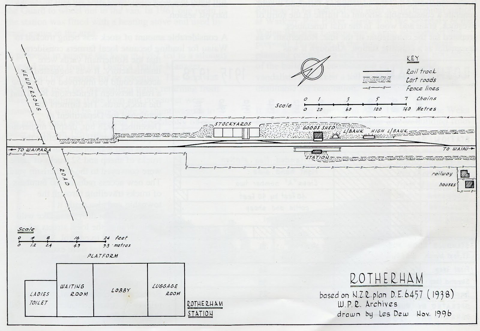
This shows a very ordinary type of rural station with limited facilities. The station building however was one of the largest on the line, it has been suggested that Rotherham was going to be the terminus of the line. When the terminus moved to Waiau four years later, it is odd that the station was not moved at the same time. Perhaps it was felt that the Rotherham settlement was large enough to warrant the additional capacity of this station building. It has been a surprise to see two houses on Dew’s diagram and the older aerial photos because the station was unstaffed when the railhead moved to Waiau. Again it’s a question of why the houses were not moved as well. Probably they ended up being occupied by surfacemen.
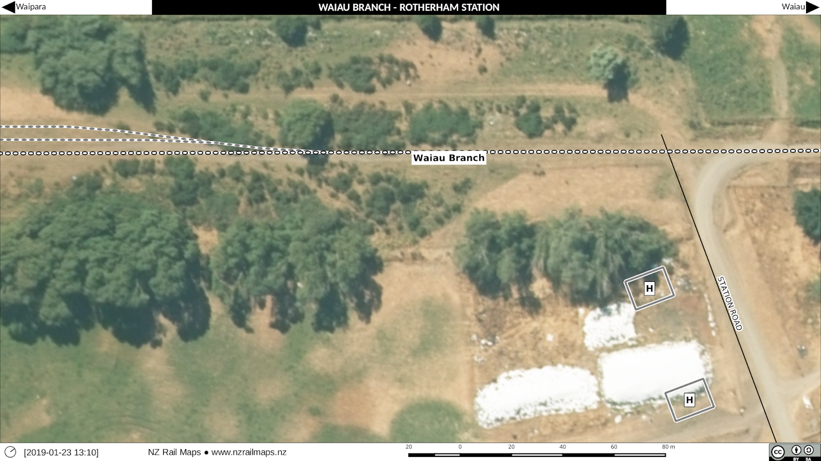
The corresponding diagram from NZ Rail Maps (traced from the aerial photos) is as below:
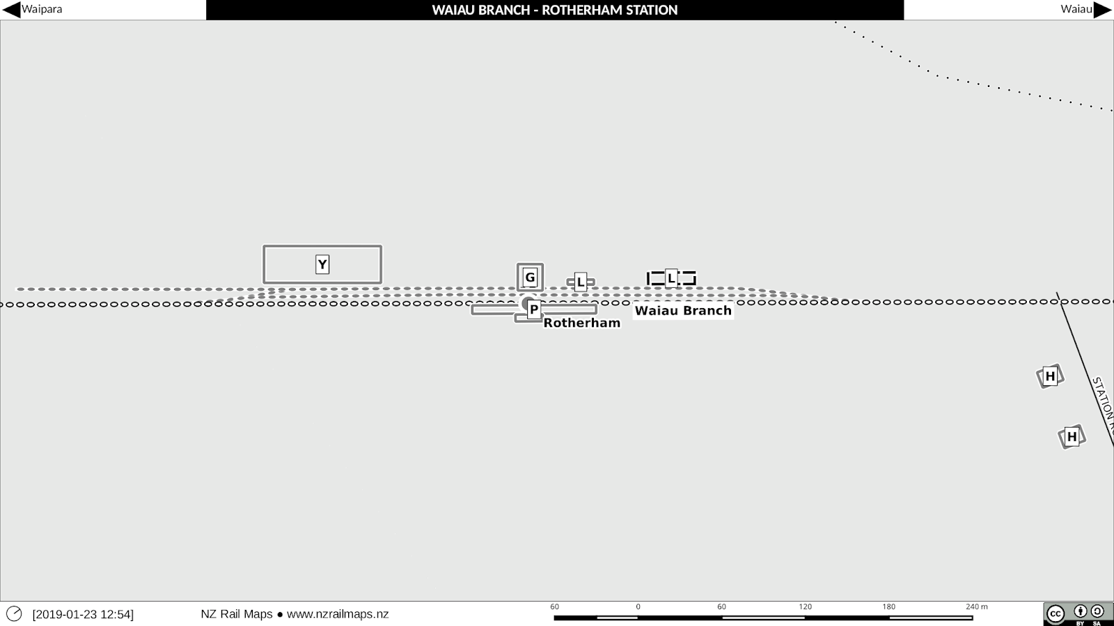
I haven’t shown the exact same area, only the detailed area so Hendersons Road is not shown on my diagram (I will show it on the zoomed in versions of the maps posted below).
Rotherham Overview
This map shows the township along with the position of the railway yards.
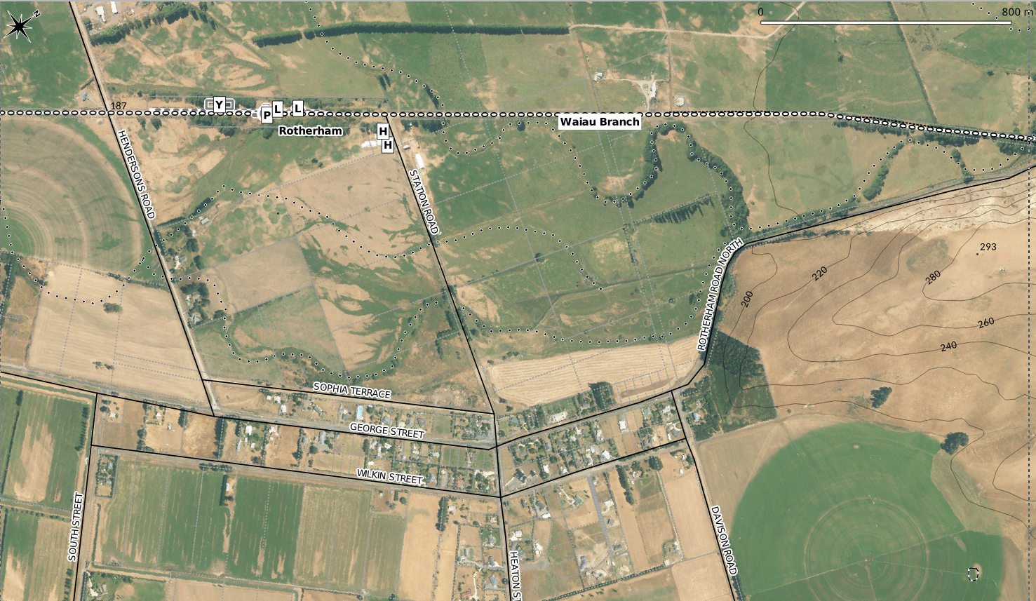
As we can see, the railway station was about 700 metres from the main street of the town.
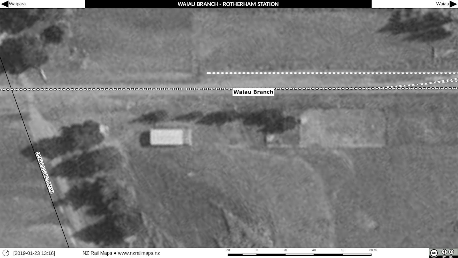
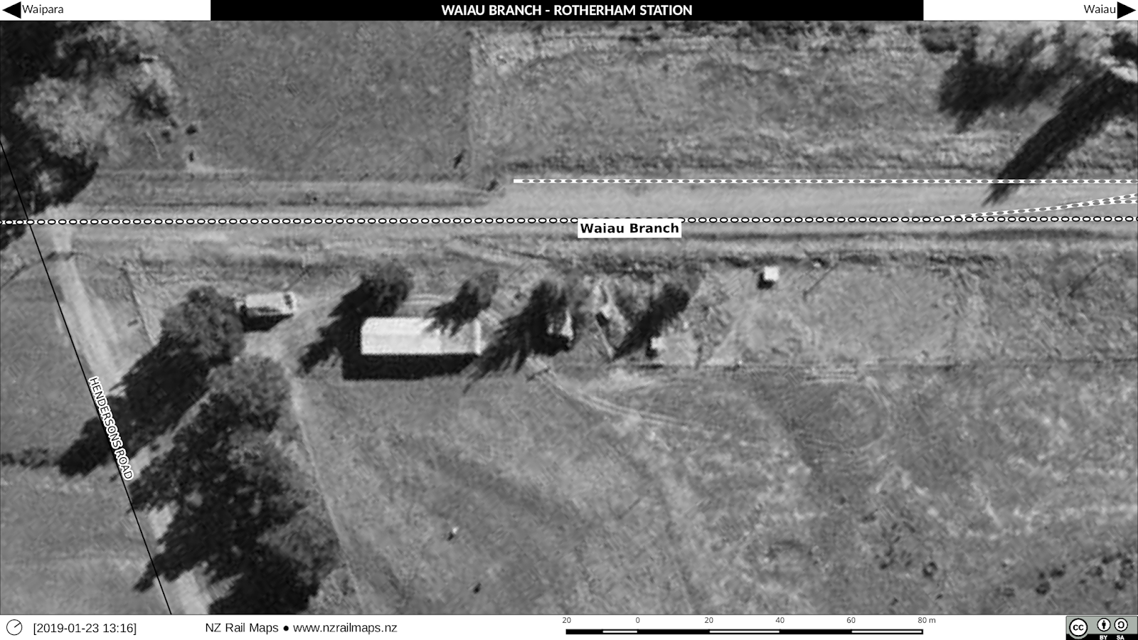
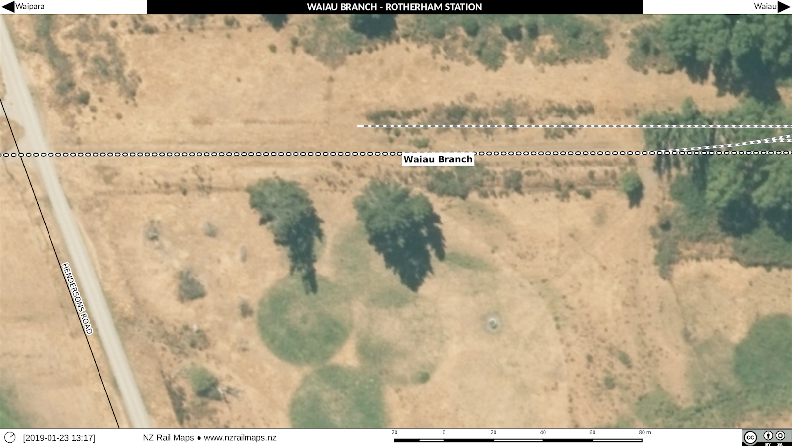
We now turn to the detailed aerial photo maps of the station yard as follows. Aerial photos used are from 1966, 1975 and 2013. Since the 1975 aerial
photo is by far the best quality of the historical images, what did we
gain from a 1966 aerial? This one did in fact show the stockyards and
the houses, which had all disappeared by 1975. The goods shed was
removed in 1975 but is still visible on the aerial photo taken that
year.
South end of the station yard
This series of maps shows approximately a third of the distance between Station Road and Hendersons Road, at the Hendersons Road end. There is not a lot to see in these maps but we can note that the buildings present on private property along the eastern boundary of the railway do not exist today.
Middle of the station yard
The middle third of the yard area has most of the interesting parts in it.Again we have used 1966, 1975 and 2013 aerials in that order.
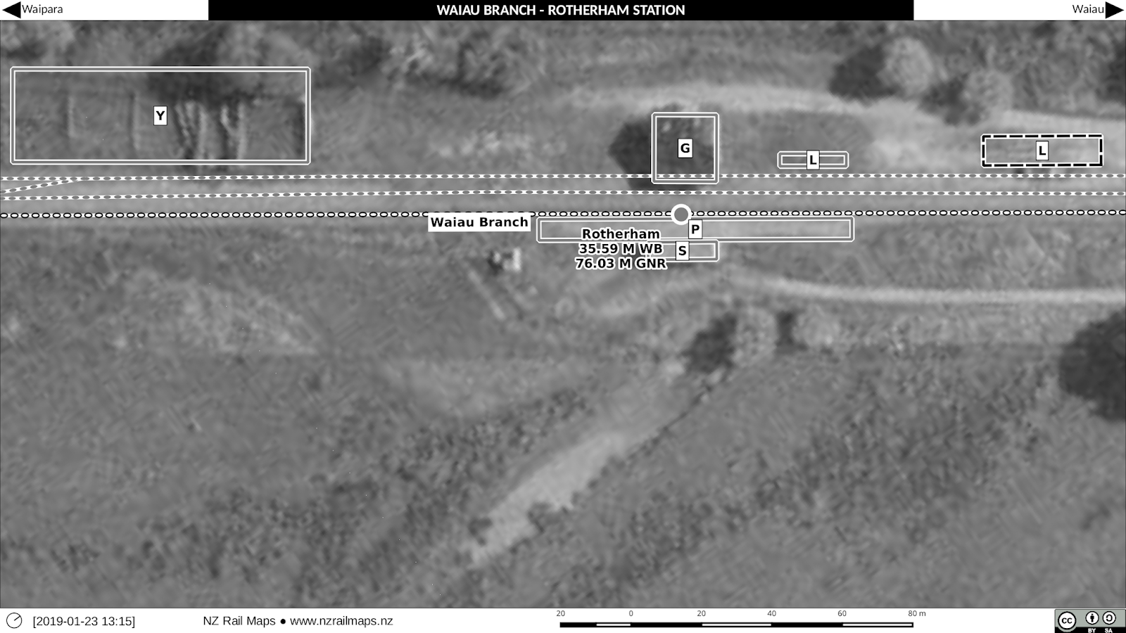
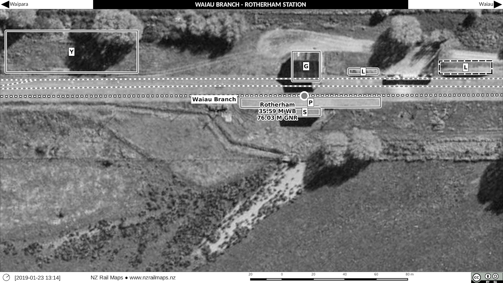
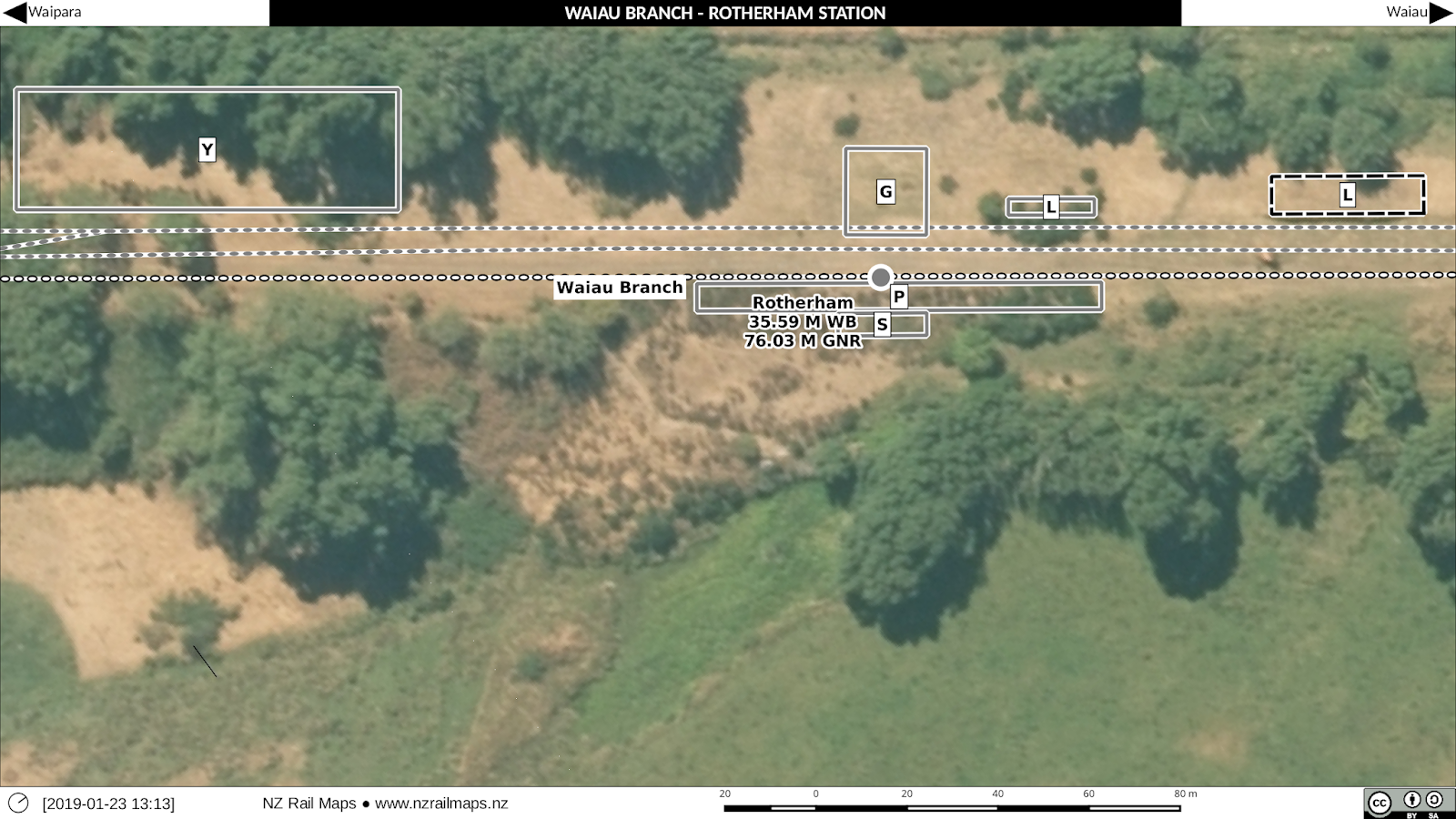
The only clearly discernible feature remaining on the ground is one of the loading banks. However, as we haven’t visited the site in 28 years, it is possible that the other loading bank or the station platform, both of which were present at that time, still exist.
North end of the station yard
The only real features of interest were the two houses. They evidently were removed sometime between the 1966 and 1975 aerial photos. (Again the aerials used are respectively 1966, 1975 and 2013).
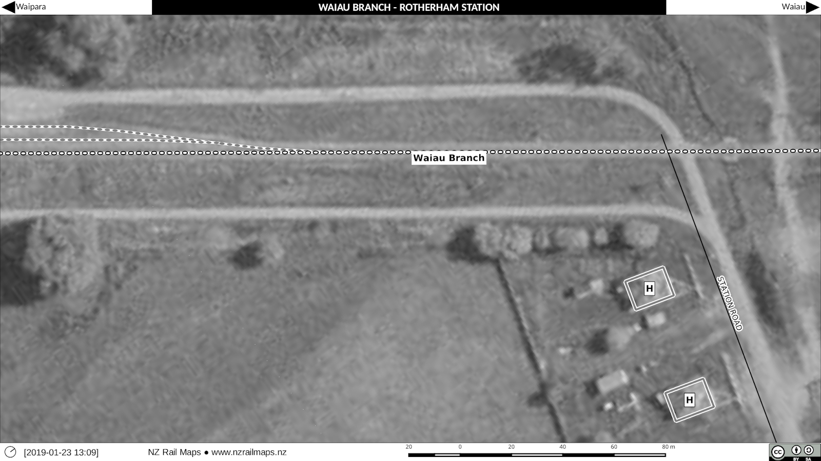
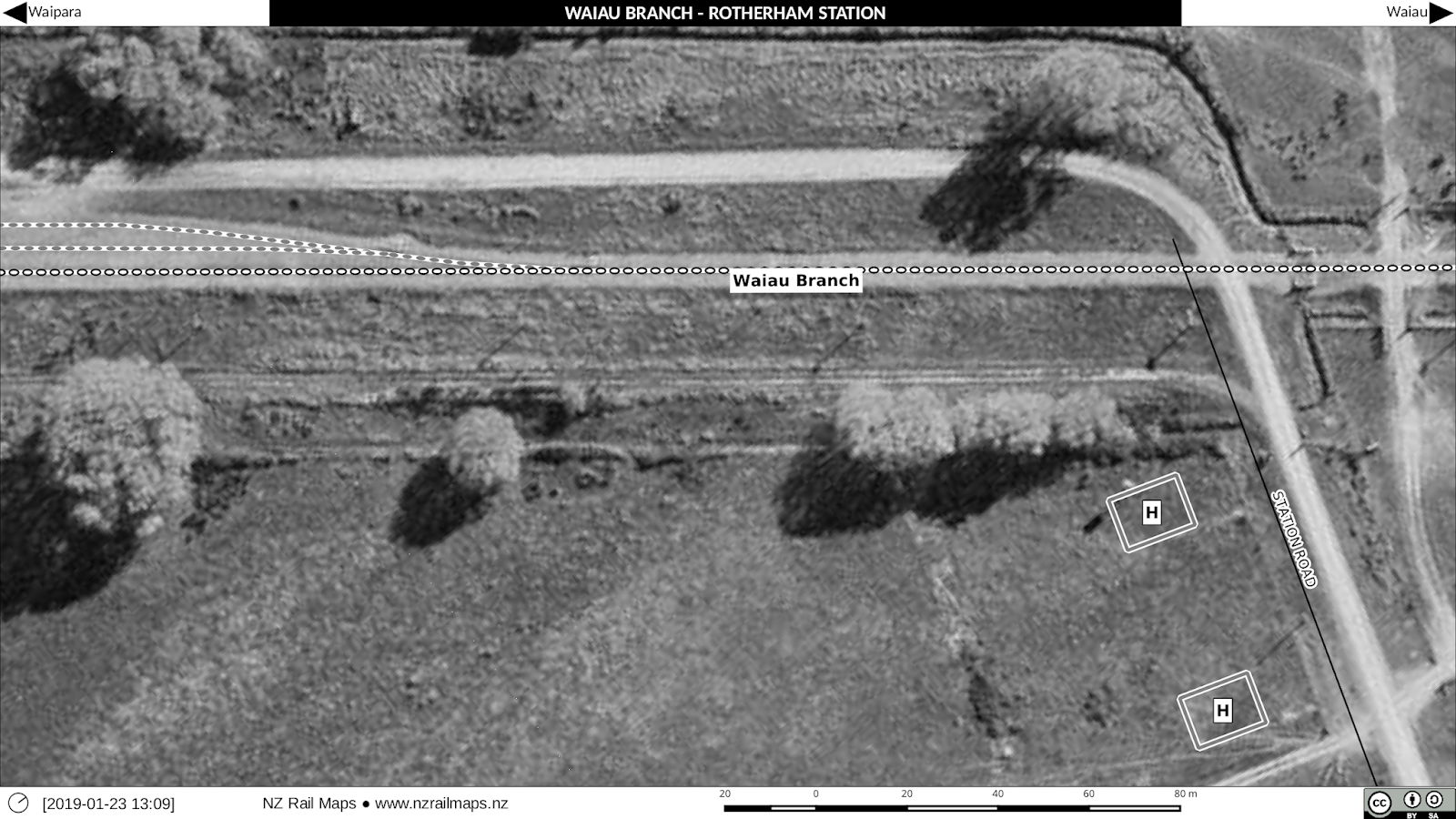
Photos of the yard
This photo is from Dew’s book (with original credit).
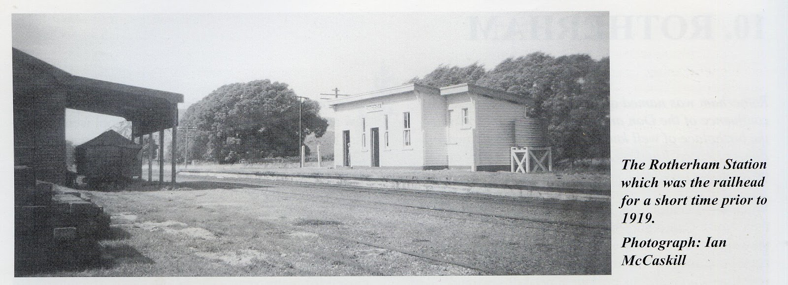
It shows the station building, the goods shed with a wagon under the veranda, and a stack of sleepers. Note the general condition of the yard and track. The goods shed was itself rectangular, but appears more square in the maps because of the veranda.
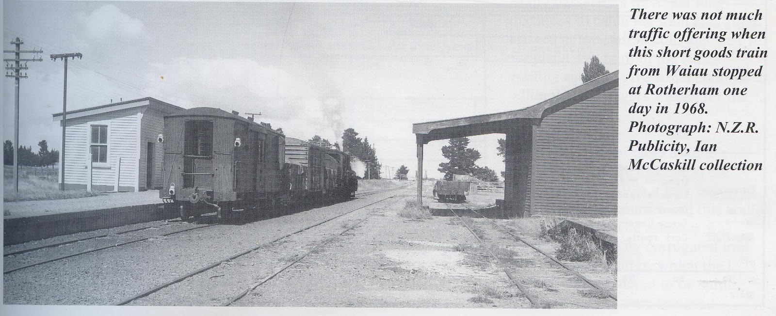
Here’s the other photo from the same book, and showing one of the loading banks as well. Stockyards are visible as this was taken in 1968.
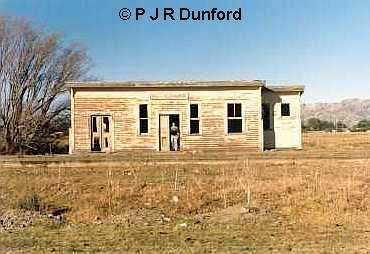
The station building taken in June 1986 – eight years after the line closed and well after the track was lifted. This was part of a trip we undertook looking at all extant remains of the branch line at that time. Note the sign board still present.
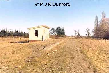
This June 1986 view of the station platform looking in the direction of Achray makes an interesting comparison with previous photos from when the line was open.
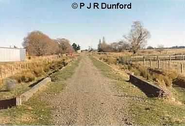
From north of the station, a concrete bridge being reused by a farm access road. The station building can just be seen in the distance.
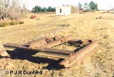
It has been suggested this sledge was used to help lift the track. Similar devices have been used around the country for purposes like these for separating rails and sleepers that were held in places by dogspikes. Some track would have been held by screwspikes which would have to be manually unscrewed before towing a device such as this along the track bed. A bulldozer or some other type of road based machine would have been required to pull the sledge. This is how the Otago Central line was lifted, except that they towed theirs with a locomotive. It works by having the loose ends of the rails fed over the back of the device, creating the necessary leverage to rip the rails and sleepers apart.
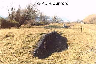
The original loading bank (with a wooden edge) is seen in this June 1986 view. It was very short and made loading flatdeck wagons difficult.
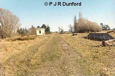
On the right in this view looking down the yard from the north end, is Rotherham’s version of a high level loading bank (as so described in the text). This was around 17 metres long and about 1.1 metres high built in 1968. The more typical structure called a “high level loading bank” around the country is about two metres high and usually is constructed of vertical railway irons driven into the ground and faced with old sleepers. We know that one of this type did exist at Culverden and possibly the ones built at Waikari, Balmoral and Waiau were the standard pattern as well. When the Waiau one was completed in the late 1960s it was cited that the one at Rotherham was unsuitable – because in reality it was a low level bank designed to load flatdeck wagons, and perhaps the original was lower than usual for these types of wagons. The main type of wagon loaded at the usual type of high level bank would be highsiders (L type) which were loaded over the top of their sides rather than through their side doors. This was essential when handling raw materials such as lime or coal, as in these situations the doors were only suitable for unloading.
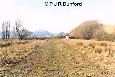
Looking north along the formation from the Station Road level crossing site. The building on the right is a farm building that can be seen in one of the previous photos.
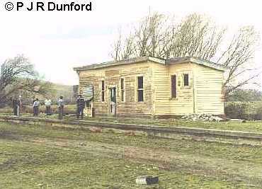
This view of the station building was taken in August 1990. It had by then been purchased by Weka Pass Railway and was to have been shifted to Waikari to be used for their passenger terminus. However because of deterioration of the building evident in this view these plans were abandoned in favour of the present building there which came from Hundalee. The Rotherham station building was sold for removal in 1993 so it is not present at the site today.
 Amuri Manor – Boutique Country Accommodation | Historic 1922 Hospital, North Canterbury